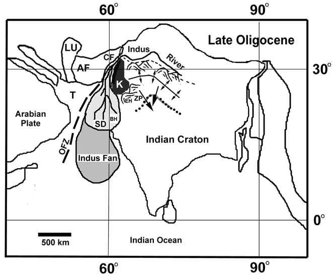
Figure 4. Schematic diagram showing the paleogeographic setting and drainage relationships between: (1) the coastline constituted by the Chitarwata Formation at Zinda Pir Dome, (2) Bugti Hills within the “Shaigalu” delta, (3) the Katawaz Block (as referred by Jadoon et al. 1994; Haq and Davis 1997), (4) the nascent Owen Fracture Zone, (5) the Chaman Fault Zone, (6) the highlands and forebulge adjacent to the Chitarwata Coast, and (7) the Indus Fan. Adapted from Qayyum et al. (2001) with plate configuration based on ODSN plate tectonic reconstruction model. Abbreviations are: BH-Bugti Hills; CF-Chaman Fault Zone; EH-Eastern Highlands; K-Katawaz Block; L-Lut Block; AF-Afghan Block; T- vestigal Tethys; OFZ-Owen Fracture Zone; SD-Shaigalu Delta; ZP-Zinda Pir Dome. Symbols used: large arrows denote the dominant paleocurrent trends in the Chitarwata Formation; dotted line depicts the Chitarwata coast; small arrows downslope to forebulge axis; small dashed line represents the suture zone; hills as indicated.