|
|
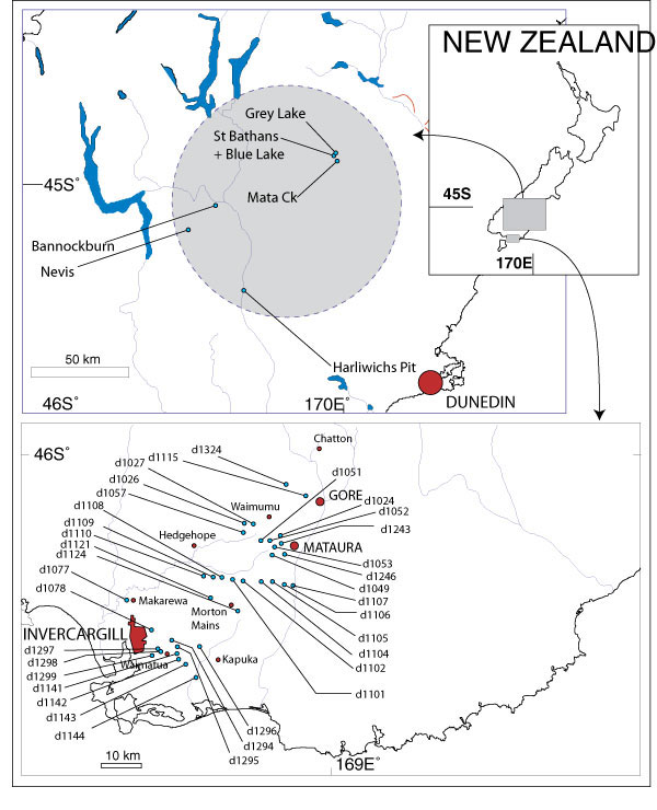
Figure 1. Location Maps. Upper map shows the extent of the Manuherikia Group schematically as a grey circle. Blue Lake is the location of sample numbers prefixed with "BL-", Grey Lake is the location of sample numbers prefixed with "GL-", Mata Creek is the location of samples prefixed with "Mata-", Harliwichs Pit is the location of sample numbers prefixed with "Harliwich-". Lower map shows the position of all drill-cores in Southland (the location of sample numbers prefixed with "Sthd-") from which fossils were obtained. For precise locations of all samples, see Appendix 1 and 2.
|