|
|
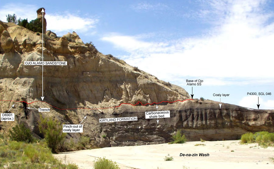
Figure 61. Photograph of Barrel Spring locality on De-na-zin Wash, looking southwest. Figure 51 shows map locations of paleobotany localities shown on photograph; localities 82303-E, 82403-A, and 110303-D are in trench on left side of photograph. Basal contact of Ojo Alamo Sandstone shown with red line (solid where clearly exposed, dotted where covered).
|