![]()
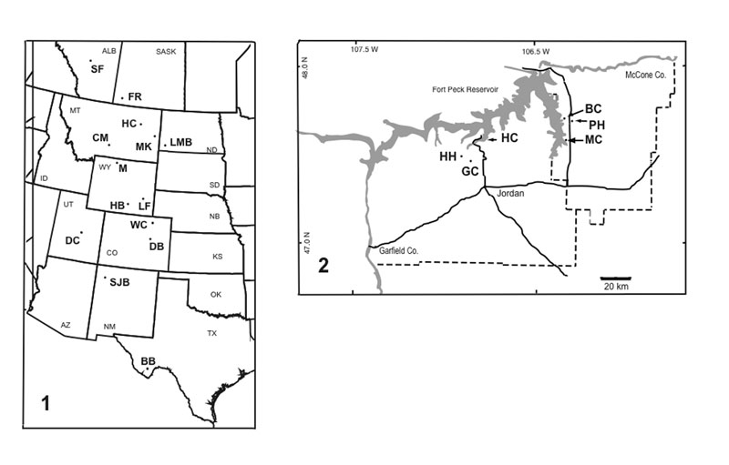
FIGURE 1. Locality maps. Figure 1.1: North American Western Interior. More comprehensive maps of localities are presented by Cifelli et al. (2004, Figure 2.2) for the Lancian and Lofgren et al. (2004, Figure 3.1) for the Puercan. Figure 1.2: Localities in Garfield and McCone Counties, Montana. Abbreviations of locality names in Figure 1.1: BB—Big Bend area, Tornillo Formation; CM—Crazy Mountain Basin, Bear Formation (Pu2/Pu3); DB—Denver Basin, Denver Formation (Pu1, Pu2); DC—Dragon Canyon, North Horn Formation (Lancian, Pu2, Pu3); FR—Frenchman and Ravenscrag Formations (Lancian, Pu1); HB—Hanna Basin, Ferris Formation (Lancian, Pu1, Pu2, Pu3); HC—Sites in Garfield and McCone Counties, Hell Creek and Tullock Formations (Lancian, Pu1, Pu2/Pu3), see Figure 1.2 for a detailed map of the area; LBM—Little Missouri Badlands, Hell Creek Formation (Lancian); LF—Powder River Basin, Lance Formation (Lancian); M—Mantua Lentil, Polecat Bench Formation, Big Horn Basin (Pu1); MK—Makoshika State Park, Fort Union Formation, (Pu2); SF—Scollard Formation, Alberta (Lancian); SHB—San Juan Basin, Kirtland and Nacimiento Formations (Lancian, Pu2, Pu3); WC—Weld County, Laramie Formation(Lancian)
Abbreviations in Figure 1.2: BC—Localities in the valley of Bug Creek; GC—Garbani Channel localities; HC—Valley of Hell Creek: HH—Hell's Hollow localities; MC—McGuire Creek localities; PH—Purgatory Hill.