FIGURE 1. Location map showing Alturas, California and major physiographic provinces. I-5, I-80, US-395, and 299 are all road identifications.
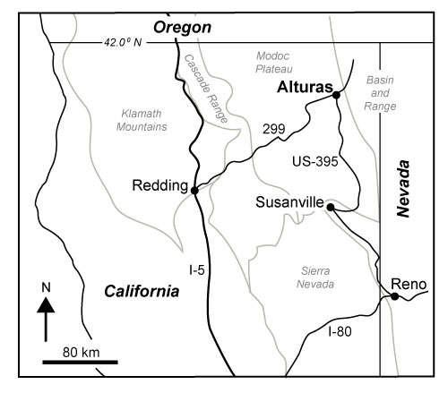
FIGURE 2. Locations of Crowder Flat Road, Signal Butte, and Rattlesnake Butte localities near Alturas, California. Expanded map of Barnes Grade area along Crowder Flat Road.
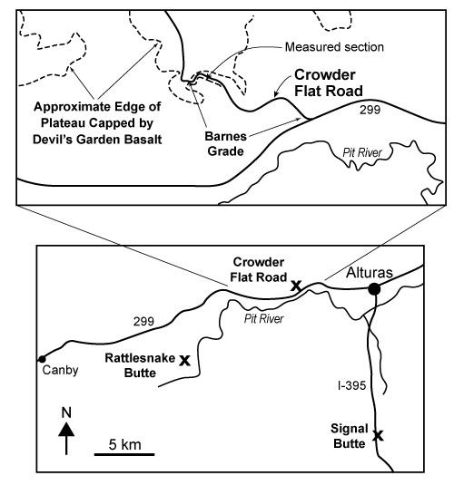
FIGURE 3. Paleomagnetic results from selected samples illustrating behavior during alternating field and thermal demagnetization.
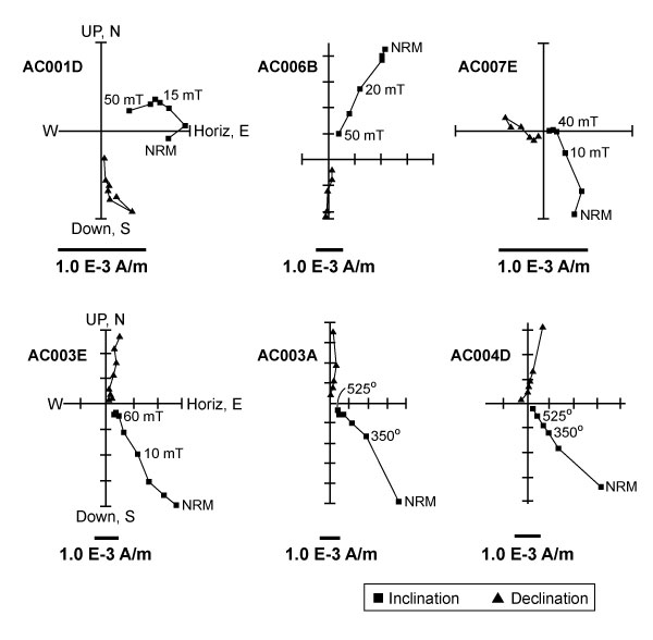
FIGURE 4. Results of strong field thermomagnetic experiments on magnetic extracts from bulk sediment samples illustrating general loss in magnetic intensity as a function of heating with all remanance removed by 580oC.
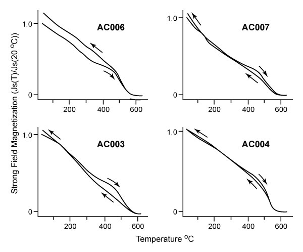
FIGURE 5. Stereonet displays of sample directions from site AC001 before (NRM) and after (30 mT) demagnetization. A normal polarity overprint in the NRM directions is removed by alternating field demagnetization.
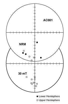
FIGURE 6. Site mean directions (1) and reversals test (2) for sites from both sample sets with site mean alpha95 < 20o. Reversed polarity site “ B ” is from the Devil’s Garden Basalt.
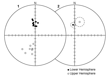
FIGURE 7. Measured stratigraphic section along Crowder Flat Road. Open symbols represent reversed polarity paleomagnetic sites and closed (black) represent normal polarity. Bone identifies stratigraphic location of UO 2424 with Mimomys (Ogmodontomys) sawrockensis fossils. ALT XX designate sample locations for tephrochronology) Grain size/lithology: c=claystone, m=mudstone, s=sandstone, b=basalt.
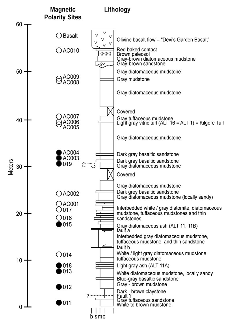
FIGURE 8. Areal distribution of the Kilgore Tuff (4.45 ± 0.05 Ma; Morgan and McIntosh, 2005). This tuff was erupted from the Heise Volcanic Field, much of which is now covered by the Snake River Plain basalts.
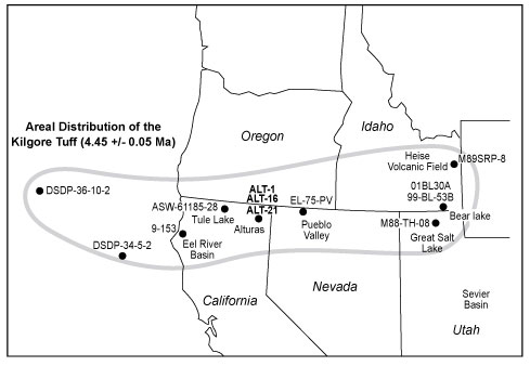
FIGURE 9. Alturas Formation stratigraphic section with magnetic polarity stratigraphy, key tuffs, and correlation across faults. The fault displacements are constrained by detailed correlation of multiple tuffs. 2.5 m down to the south on fault a and 0.5 m up to the south on fault b. Correlation of tuffs across these faults allows the normal to reversed polarity transition from 015 - 016 to be correlated with the same transition from 018 - 014. The bone symbol represents the stratigraphic position of fossil locality UO 2424. Grain size scale same as in Figure 7.
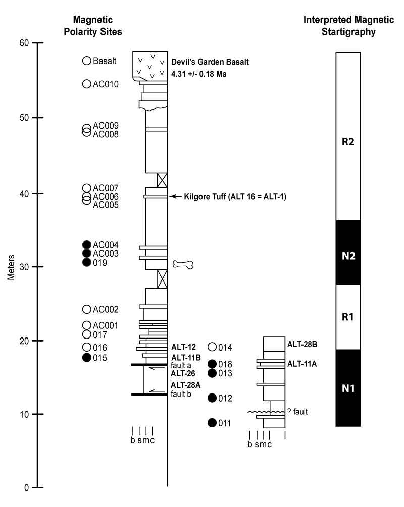
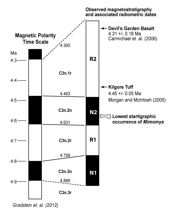
FIGURE 10. Proposed chronostratigraphy illustrating correlation to the magnetic polarity time scale of Gradstein et al. (2012) and radiometric ages for the Devil’s Garden Basalt and the Kilgore Tuff.