FIGURE 1. 1, Locality map for the Aguilares tracksite and the other tracksites with vertebratefootprints in the western area of the Ebro Basin: 1, Javier-Liédena; 2, Olejua; 3, Olkotz-Etaio; 4, Alcanadre; 5, Desojo-Los Arcos; 6, Cenicero; 7, Logroño; 8, Aguilares. 2, Composite lithostratigraphic and magnetostratigraphic logs of the Cabezo Marijuán stratigraphic section (see Larrasoaña et al., 2006) and their correlation to the ATNTS2004 of Lourens et al. (2004). The position of Aguilares tracksite is described in this study; for the other fossil localities see Murelaga (2000) and see Ruiz-Sánchez et al. (2012).
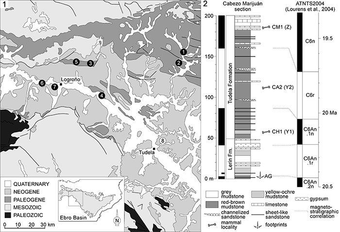
FIGURE 2. Photographs and sketches of the blocks of the Aguilares bird footprints. 1, AG1 block; 2, AG2 block; 3, AG3 block; 4, AG4 block.
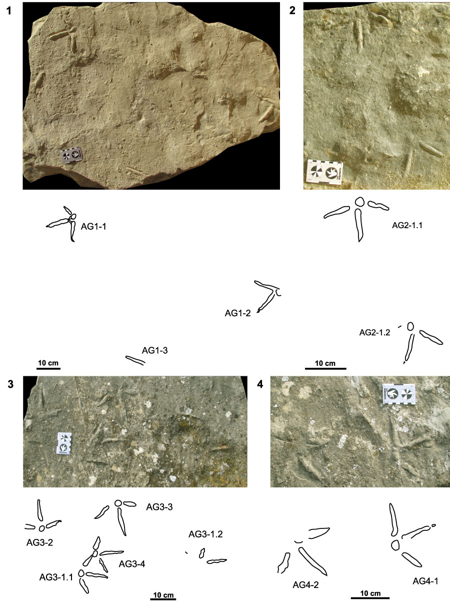
FIGURE 3.1, Picture; 2, false-color depth map of the photogrammetric model; 3, contour lines map with 0.5 mm of equidistance of AG1-1 footprint. 4, Picture, 5, false-color depth map of the photogrammetric model; 6, contour lines map with 0.5 mm of equidistance of Uvaichnites riojana holotype.
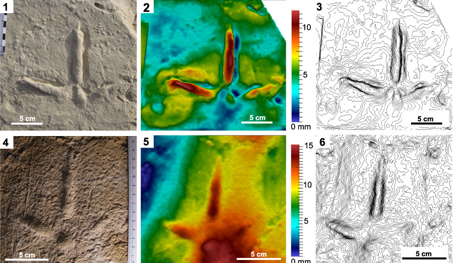
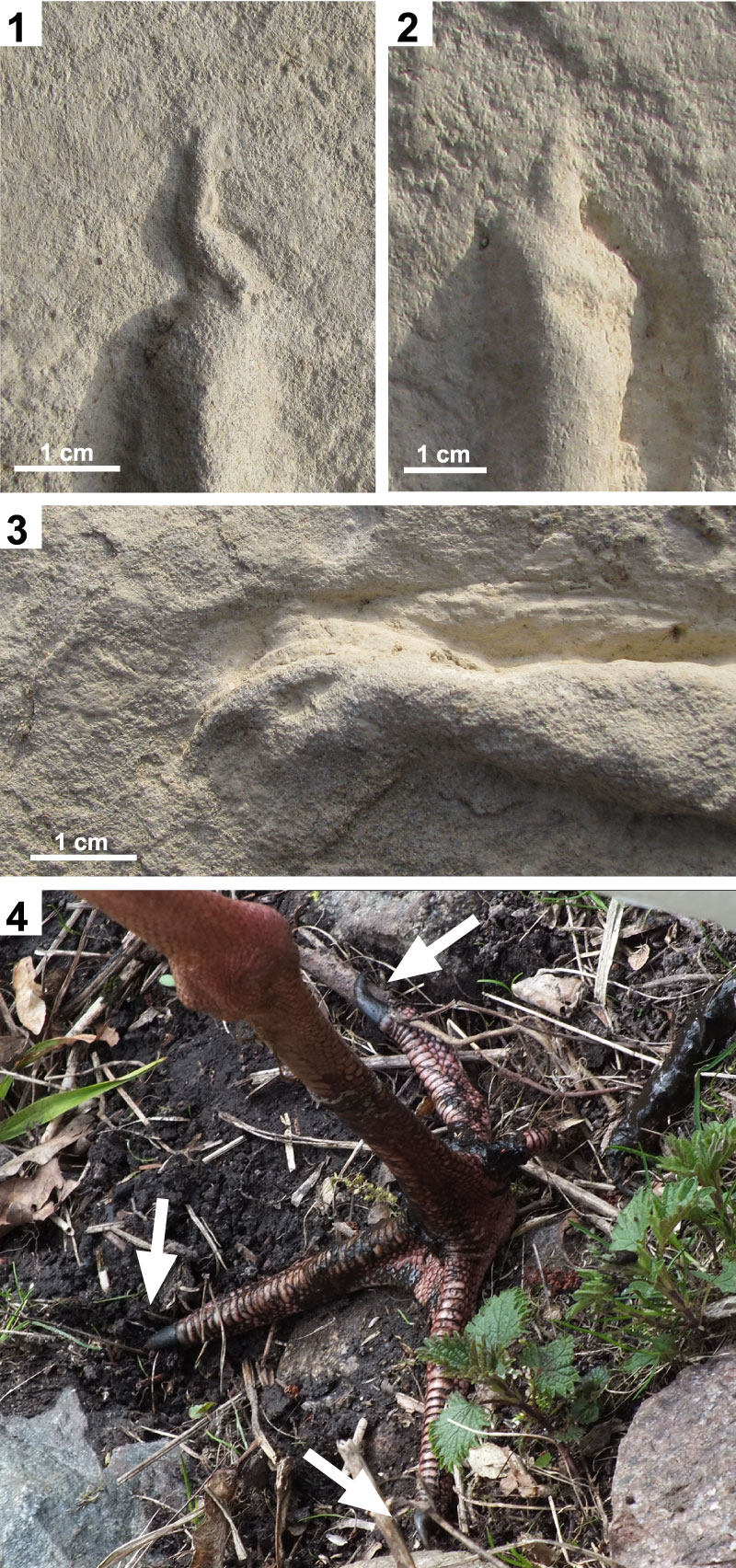
FIGURE 4. Detail of claw marks of Aguilares Uvaichnites riojana. 1, Digit III of AG1-1; 2, digit III of AG1-2; 3, digit IV of AG1-1; 4, Extant crane foot Grus leucogeranus. White arrows indicate the foot claws.