FIGURE 1. Geological map of the Pin River valley, Lahaul and Spiti district of Himachal Pradesh, India, showing location of the fossil specimen demarcated by star.
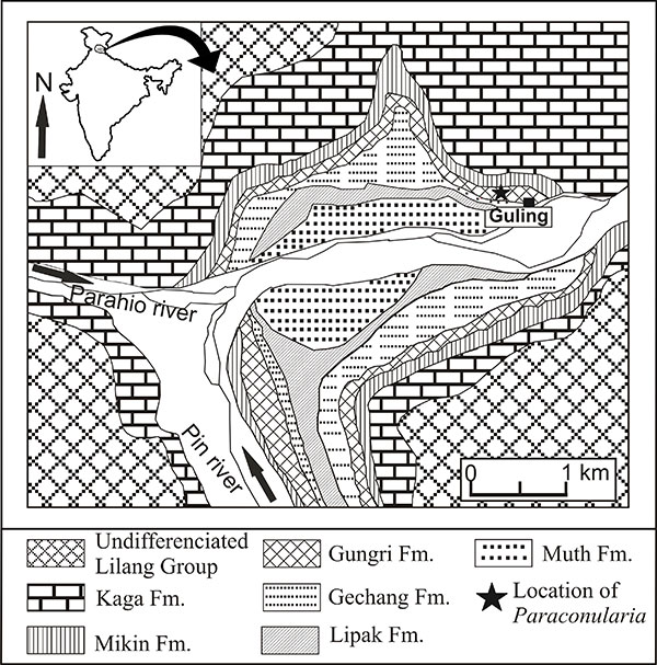
FIGURE 2. Litholog showing the stratigraphic level of the Paraconularia sp. with respect to Gungri Formation.
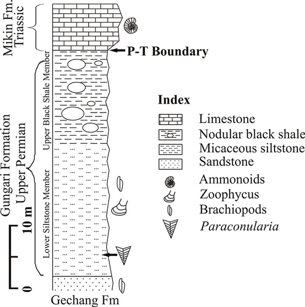
FIGURE 3. 1, Paraconularia embedded in the Micaceous siltstone of the lower part of Gungri Formation, Guling village. 2, Upper Nodular Black Shale Member of the Gungri Formation. 3, Permian-Triassic boundary, Guling village. 4, Ammonite bearing Triassic limestone of Mikin Formation, opposite to Guling village.
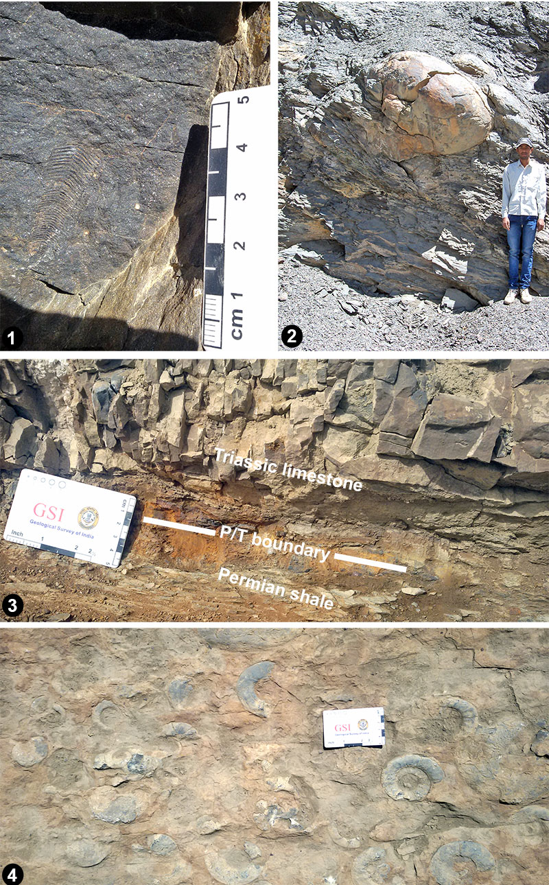
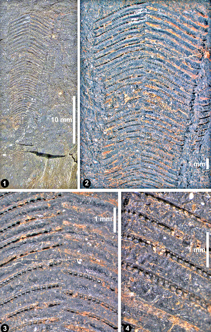
FIGURE 4. Paraconularia sp. embedded in the micaceous siltstone of the Gungri Formation. 1, View of single face. 2, Close-up view showing well-developed nodes on facial ridge (transverse rib) and interspace. 3, Apertural side showing widely spaced facial ridges, which alternately arranged either side of the midline. 4, Close-up view of the apertural side showing nodes on facial ridge.