FIGURE 1. Catlins Coast fossil locality map. Arrow in the upper inset map points to a rectangle that delineates the general region along the southern coast of New Zealand’s South Island. The upper map indicates the whole area regarded as ‘Catlins Coast’ in this work, and shows the Owaka and Chasm localities, which are a little distant from the others, and it delineates a rectangular area, which is shown in detail in the lower map.
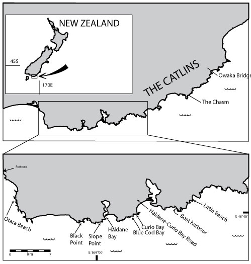
FIGURE 2. Representative Catlins Coast fossil locality photographs. 1. The Chasm. Fossils are from loose blocks at the base of the cliffs. 2. Little Beach. Note tree trunk to left of rock hammer, associated with soil (arrowed) 3. Boat Harbour. Approximate location of fossil site arrowed. 4. Otara Beach. Note tree stump (arrowed).
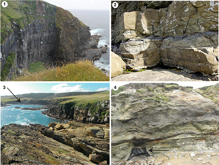
FIGURE 3. Summary of the current understanding of stratigraphic relations of the fossil localities. These are simplified stratigraphic columns through the Slope Point Block and the Brothers Block (Pole, 2004) and the South Limb of the Southland Syncline (based on Speden, 1971). Pole (2004) proposed that all terrestrial sediments should be recognised as False Island Formation. For ease of comparison, the formations of Speden (1971) are indicated for the South Limb.
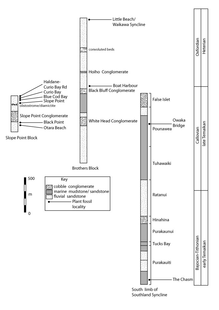
FIGURE 4. Cladophlebis patagonica pinnules. 1. LX1498, Black Point (Note the distinct apical broadening of the pinnule base); 2. LX1074, Curio Bay; 3. LX1197, Slope-02; 4. LX1069, The Boat Harbour; 5. LX1076, Curio Bay (Note that some of the veins dichotomise twice.); 6. LX2070, The Boat Harbour (Note the pronounced apical broadening of the pinnule base which continues to the adjacent pinnule as a ‘wing’. All scale bars equal 10 mm).
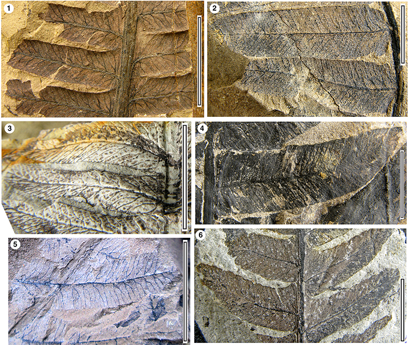
FIGURE 5. Coniopteris murrayana. 1. Fragment of fertile secondary pinna, LX2066, Slope-03 (scale bar equals 10 mm); 2. Detail of fertile pinnules, LX2066, Slope-03 (scale bar equals 10 mm).
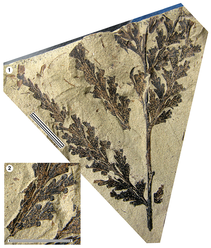
FIGURE 6. Sphenopteris travisii. 1. LX2067, Slope-03; 2. LX1180, Blue Cod Bay; 3. LX665 Blue Cod Bay. All scale bars equal 10 mm.
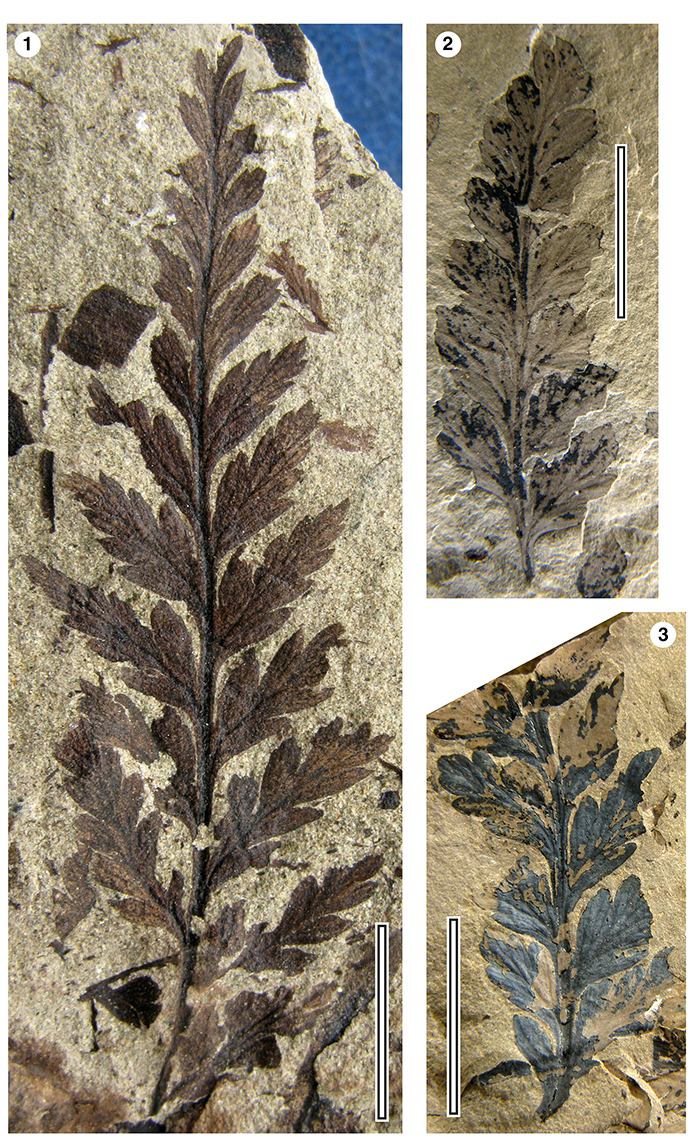
FIGURE 7. Hausmannia sp. 1. LX2361, Otara-36 (scale bar equals 10 mm).
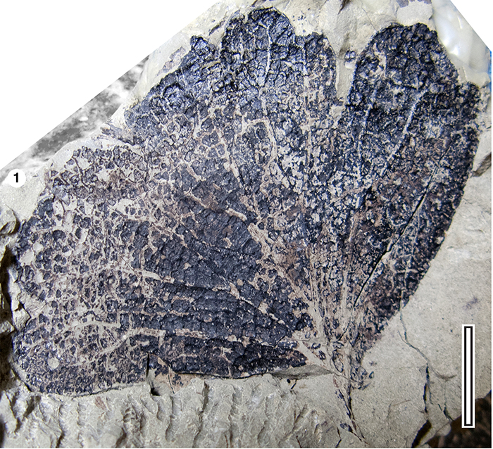
FIGURE 8. Equisetum laterale. 1. Diaphragm, LX2684, Otara-35; 2. Leaf sheath, LX1008, Owaka; 3. Possible rhizome, LX1066, Little Bay-01. All scale bars equal 10 mm.
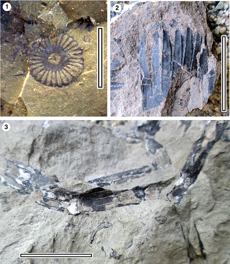
FIGURE 9. Otozamites douglasii 1. Photographed in the field, Slope-04; 2. LX1231, Curio Bay; 3. LX656, Slope-01, with slightly auriculate acroscopic margin of the pinnule bases; 4. LX1191, Black Point, showing distinctly auriculate acroscopic margin of the pinnule bases; 5. LX1231, Curio Bay, with contracted basiscopic margin of the pinnule bases. All scale bars equal 10 mm.
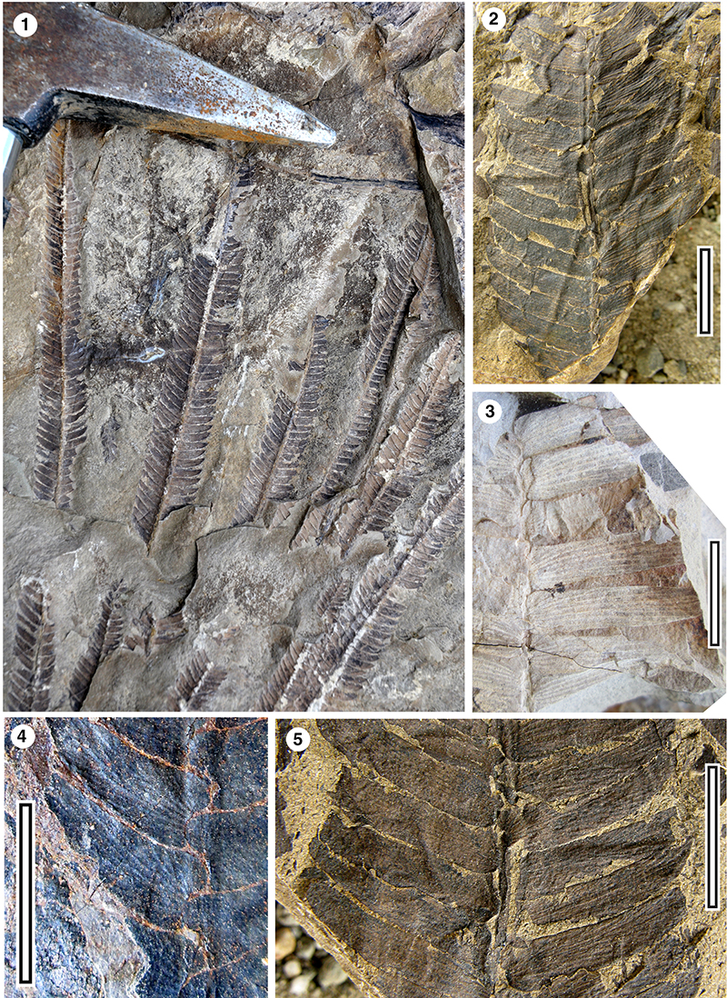
FIGURE 10. Pseudoctenis? ensiformis 1. LX1204; 2. LX1212; 3. LX1206; 4. LX1214. All Haldane-Curio Bay Road, scale bars equal 10 mm.
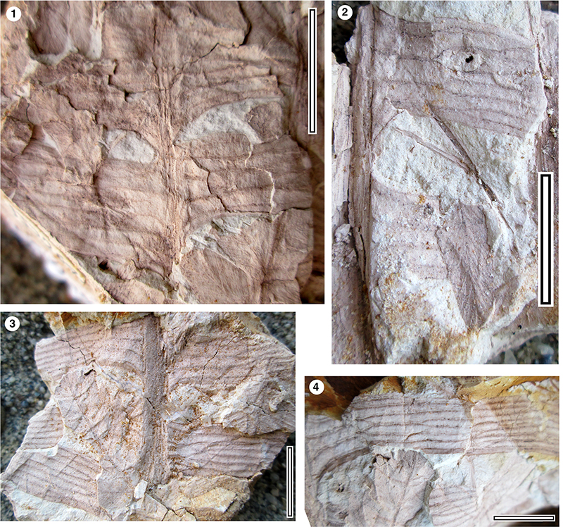
FIGURE 11. Rintoulia pectinata 1. LX1029, Little Bay-03; 2. LX1021, Little Bay-03; 3. LX669, Owaka. All scale bars equal 10 mm.
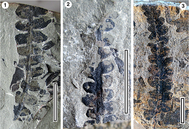
FIGURE 12. Archangelskya furcata. 1. LX0672, Owaka; 2. LX0673, Owaka. All scale bars equal 10 mm.
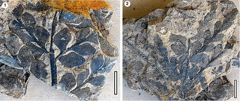
FIGURE 13. Pachydermophyllum austropapillosum 1. LX659, The Chasm; 2. LX1014, Little-03; 3. LX658, The Chasm. All scale bars equal 10 mm.
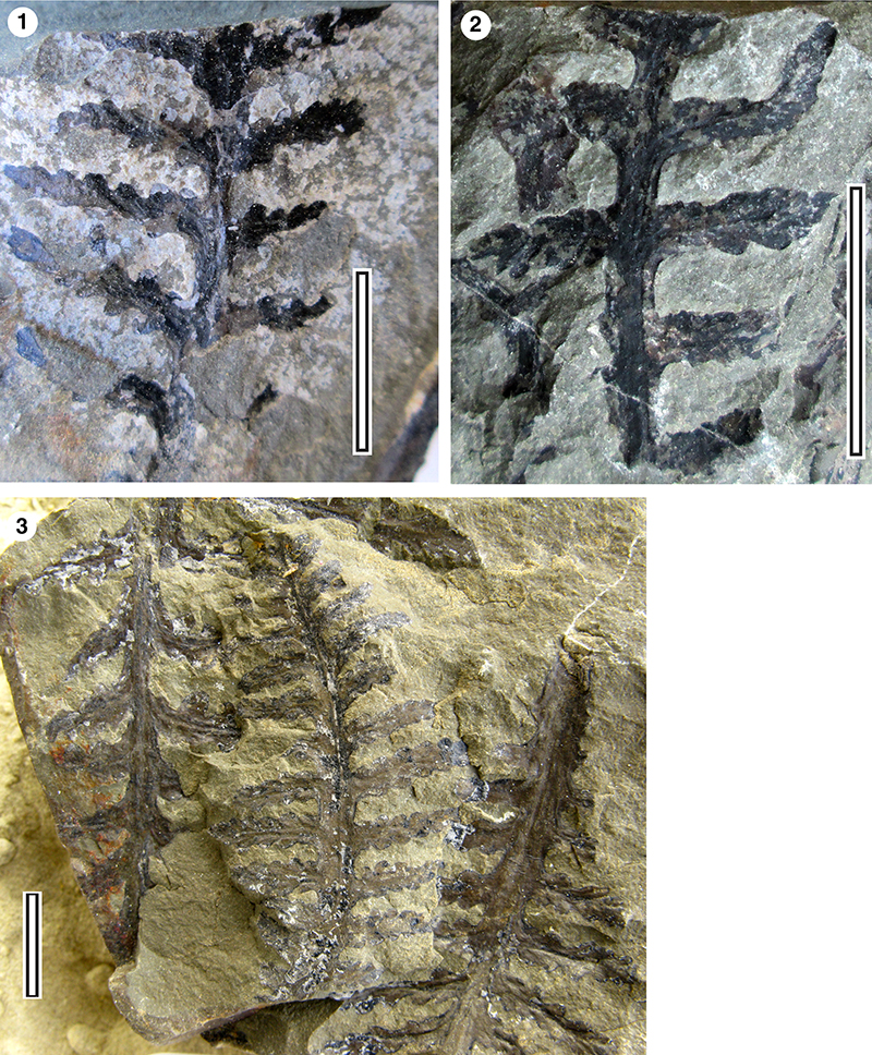
FIGURE 14. Taeniopteris leaves. 1. Taenopteris spatulata, LX1097, Curio Bay; 2. Taeniopteris crassinervis, LX2365, Curio Bay; 3. Taeniopteris sp. ‘narrow’, LX2365, Little Bay-03. All scale bars equal 10 mm.
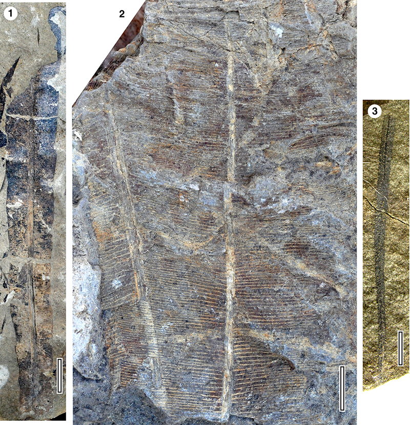
FIGURE 15. Taeniopteris spatulata details. 1. LX1218, Curio Bay; 2. LX1097, Curio Bay; 3. LX1277, Curio Bay; 4. LX1241, Curio Bay. All scale bars equal 10 mm.
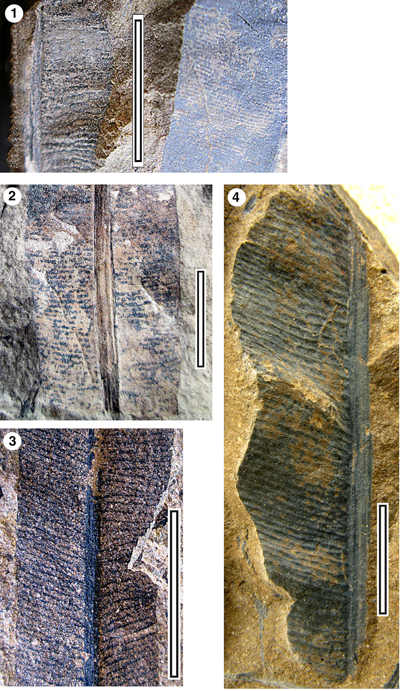
FIGURE 16. Elatocladus confertus 1. LX1060, Little Bay-01; 2. LX0674, Little Bay-01; 3. LX1050, Little Bay-01; 4. LX1057, Little Bay-01; 5. LX1107, Curio Bay; 6. LX1147, Blue Cod Bay; 7. LX1090, Curio Bay. All scale bars equal 10 mm.
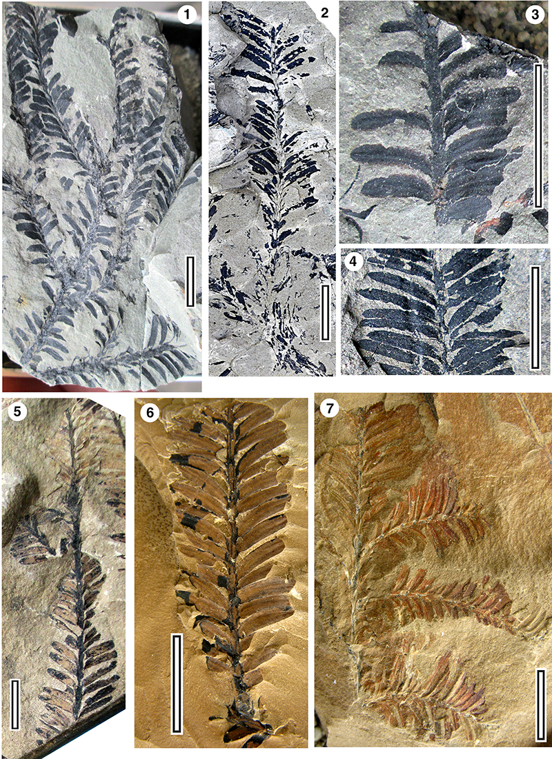
FIGURE 17. Elatocladus spp. 1. Elatocladus sp. A, LX1054, Little Bay-01; 2. Elatocladus sp. A, LX1061, Little Bay-01; 3. Elatocladus sp. A, LX1131, Little Bay-01; 4. Elatocladus sp. A, LX1159, Little Bay-01; 5. Elatocladus sp. B, LX2077, Blue Cod Bay. All scale bars equal 10 mm.
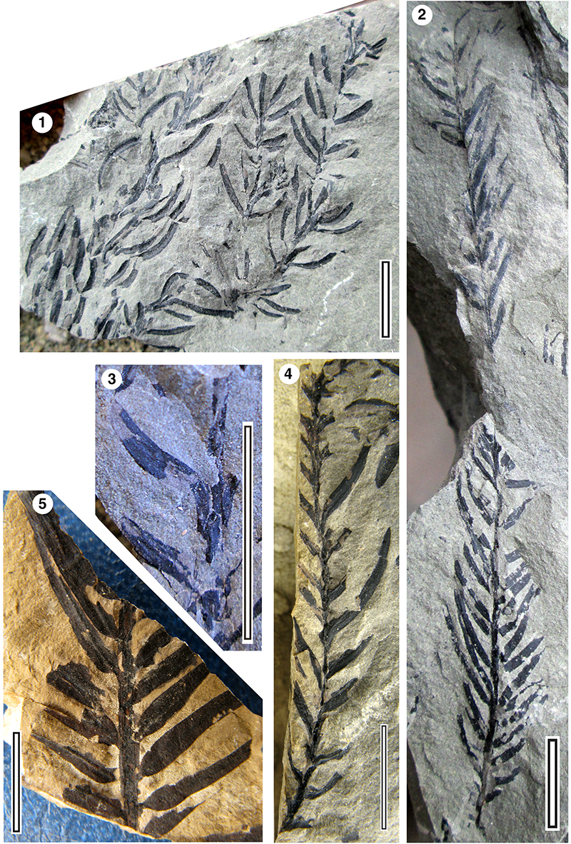
FIGURE 18. Bellarinea richardsii, all Little Bay-01. 1. LX0676; 2. LX0675; 3. LX1275; 4. LX1130. All scale bars equal 10 mm.
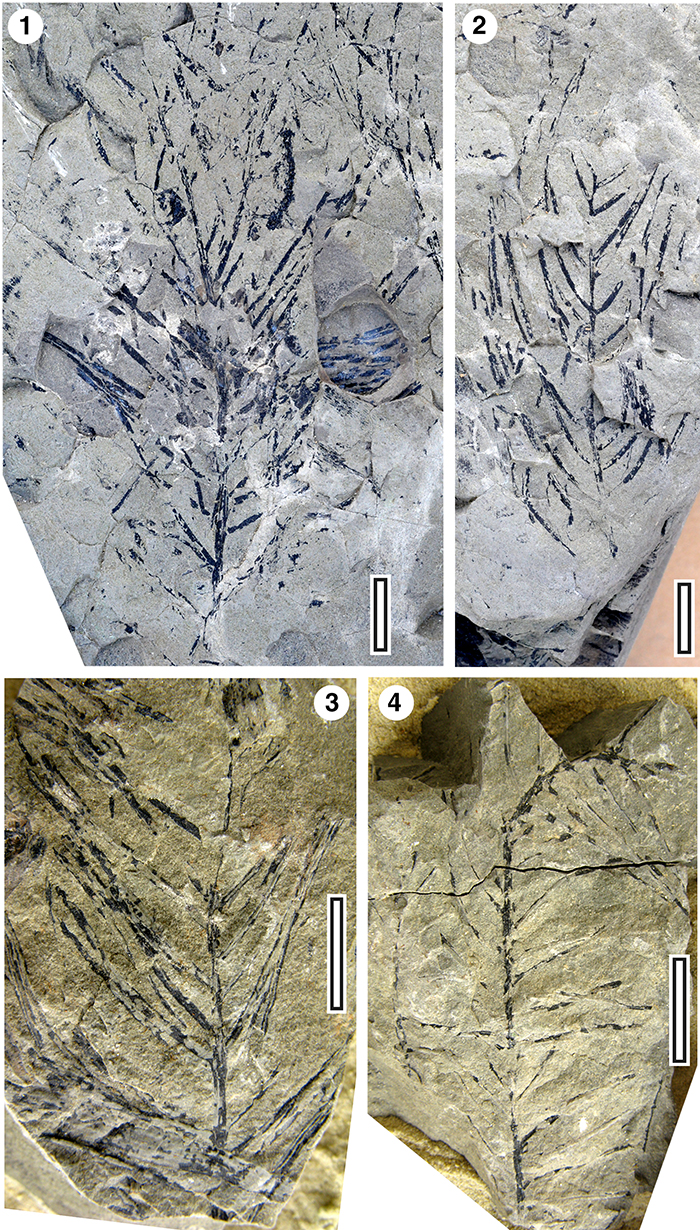
FIGURE 19. Podozamites gracilis 1. LX1084, Curio Bay; 2. LX1012, Little-03; 3. LX1084, Curio Bay. All scale bars equal 10 mm.
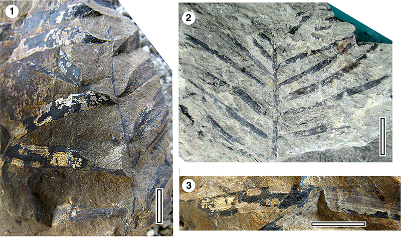
FIGURE 20. Pagiophyllum sp. 1. LX1142, Owaka; 2. LX1016, Little-03; 3. LX1023, Little-03. All scale bars equal 10 mm.
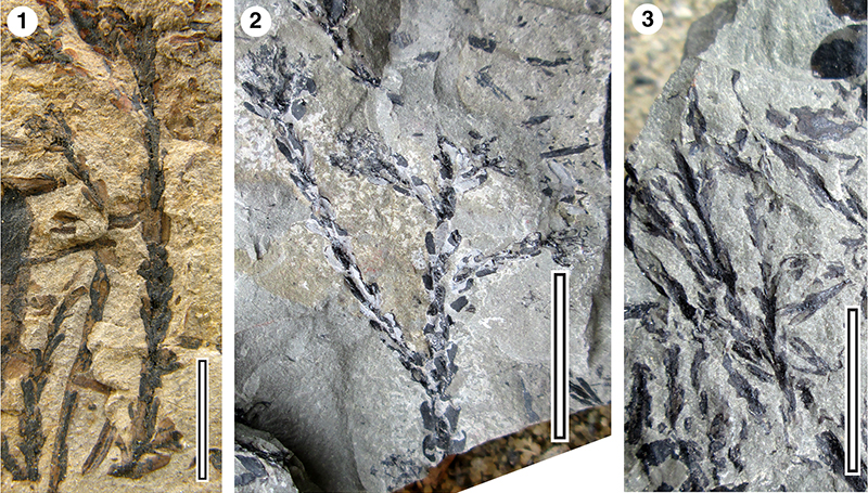
FIGURE 21. Pityophyllum sp. 1. LX656, Slope-01 (scale bar equal 10 mm).
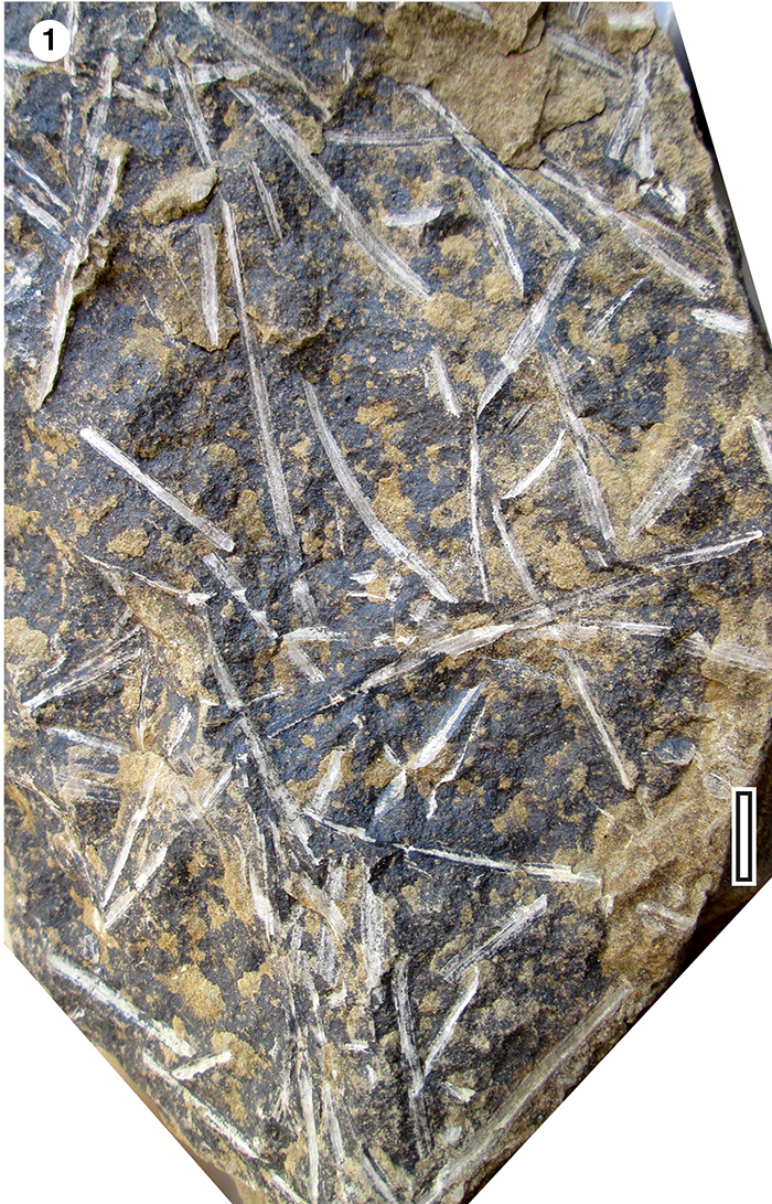
FIGURE 22. Araucarites cutchensis 1. Ovulate scale (LX2364); 2. Counterpart of previous (LX2364); 3. Two cone scales (LX2367). All Little-02, scale bars equal 10 mm.
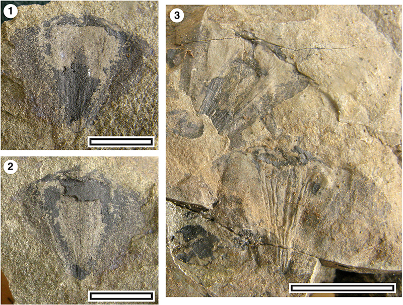
FIGURE 23. Palissya batrumi 1. Specimen showing external morphology, LX721, Little Beach (Note adjacent Pityophyllum); 2. Specimen with apical part split longitudinally, revealing the axis, LX1096, Curio Bay.; 3. Specimen weathered to reveal the adaxial surface with paired ovule/scale units, LX2238, Otara-20. All scale bars equal 10 mm.

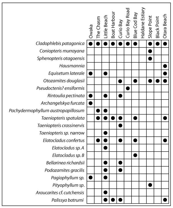
FIGURE 24. Summary chart of taxa distribution across the main localities and the total number of catalogued specimens.