FIGURE 1. Examples of anthropological actions that create bias in natural history collections and when they occur.
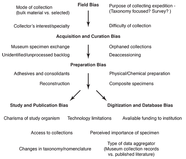
FIGURE 2. Location of the Spence Shale A. Location in the western United States. B. Topographic relief showing the main mountain ranges and collecting localities. The Wasatch Range contains the High Creek and Blacksmith Fork localities, and the Bear River Range contains Emigration Canyon, Oneida and the type locality Spence Gulch. C. Enlargement of the Wellsville Mountain Range (MH=Miners Hollow, CFC=Calls Fort Canyon, DC=Donation Canyon, CC=Cataract Canyon, AC=Antimony Canyon, HC=Hansen Canyon). Modified from Whitaker et al., 2020.
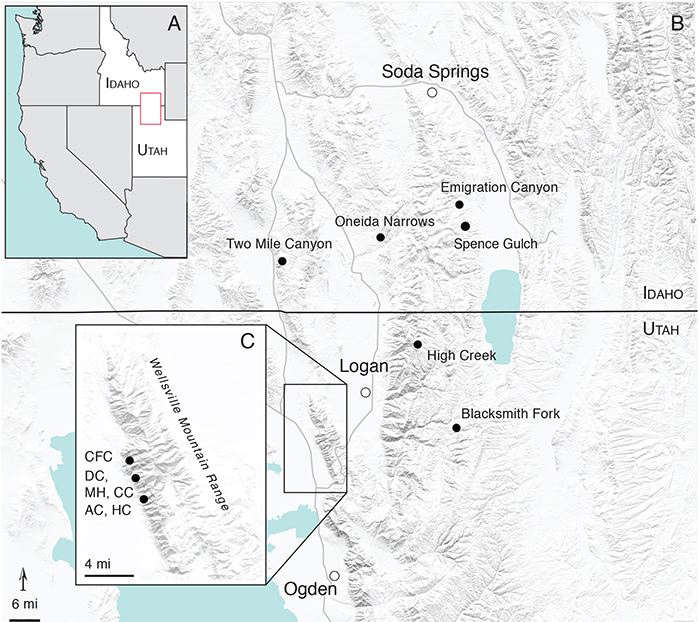
FIGURE 3. Percentage of taxonomic groups in the KUMIP Spence Shale collection by specimen counts.
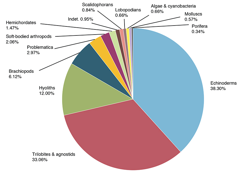
FIGURE 4. Specimens in the KUMIP collections by locality, breaking down number of specimens of biomineralizing and soft-bodied taxa from each locality.
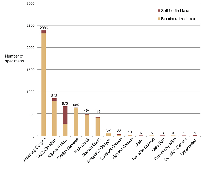
FIGURE 5. Composition of the Spence Shale fauna by number of genera, comparing the most recent faunal list based on Kimmig et al., 2019; and results from the PBDB. Genera in the PBDB not present on the most recent list are colored in red. The proportion of genera from each taxonomic group is expressed as a percentage above each count.
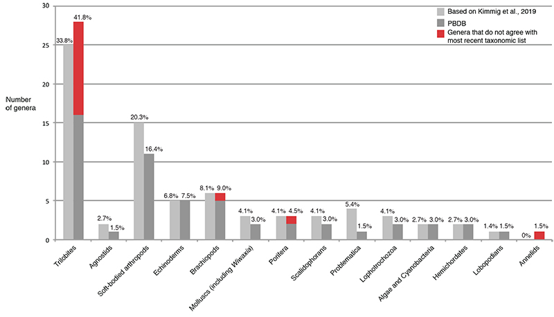
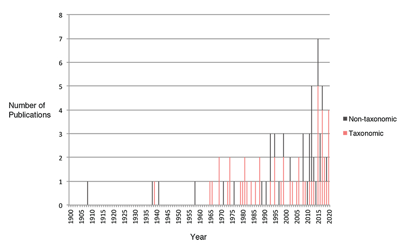
FIGURE 6. Publications over time that refer specifically to Spence Shale specimens or use quantitative data from the Spence Shale in an analysis.