FIGURE 1. Geologic map of the Mahajanga Basin field area in northwestern Madagascar, including Berivotra and Lac Kinkony Study Areas. Modified with permission from Rogers et al. (2013).
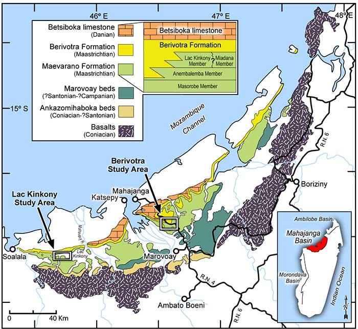
FIGURE 2. Albula sp. fossils from the Maevarano Formation. A-B , occlusal and lateral view of tooth plate (UA 11388). C-D , occlusal and ventral view of dentary (DMNH EPV. 136301). Scale bars equal 1 cm.
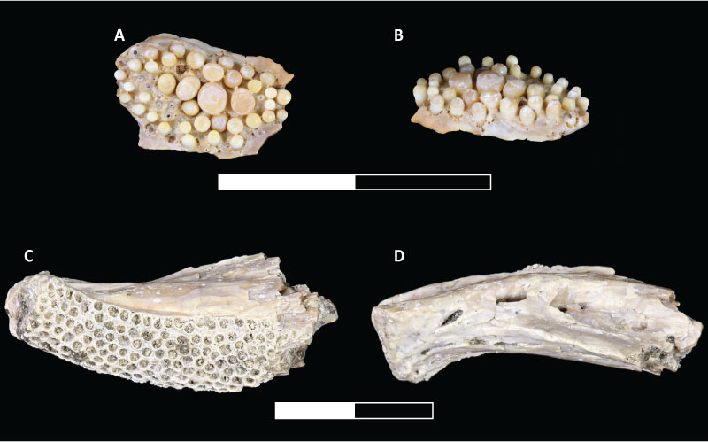
FIGURE 3. Egertonia sp. fossils from the Maevarano Formation. A-B , occlusal and cross-section views of tooth plate (UA 11389). C-D , occlusal and cross-section views of tooth plate (DMNH EPV. 136302). E-F , occlusal and cross-section views of tooth plate (DMNH EPV.136303). G-I , occlusal, cross-section, and basal views of tooth plate (UA 11390). Scale bar equals 1 cm; small arrows used in cross-section view to highlight vertically stacked teeth.
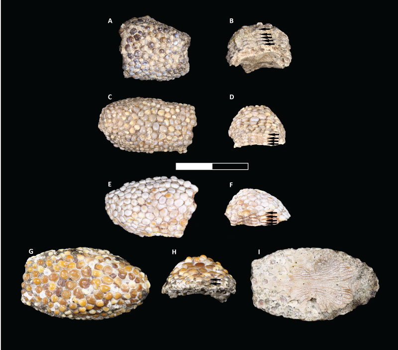
FIGURE 4. Paralbula sp. fossils from the Maevarano Formation. A-B occlusal and lateral views of tooth plate (DMNH EPV.136304). C-D occlusal and lateral views of tooth plate (UA 11391). E-F , occlusal and lateral views of tooth plate (UA 11392). Scale bar equals 1 cm.
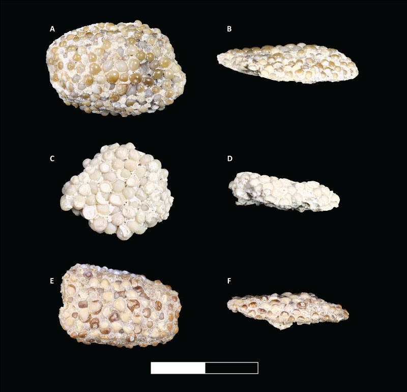
FIGURE 5. Elopomorpha gen. indet centra from the Maevarano Formation. Each specimen is shown in cranial view (1s), lateral view (2s), dorsal view (3s), and ventral view (4s). A , vertebra (DMNH EPV. 136305). B , vertebra (DMNH EPV. 136306), note that B3 shows a broken dorsal margin view. C , vertebra (DMNH EPV.136307). D , vertebra (DMNH EPV. 136308). E , vertebra (UA 11393). F , vertebra (UA 11394). Scale bar equals 1 cm.
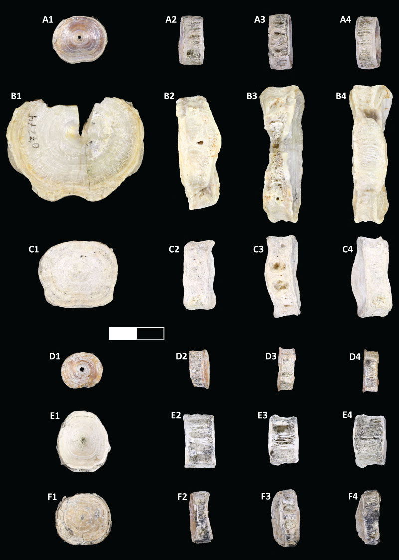
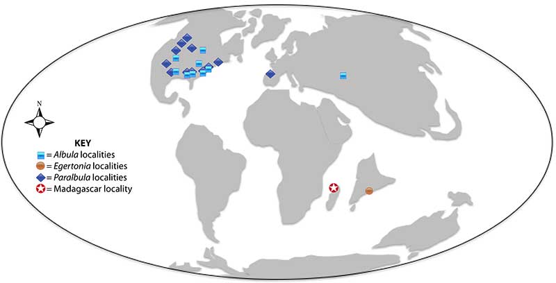
FIGURE 6. Late Cretaceous Paleogeographic Map showing known fossil localities (clustered by state if applicable) of Albula, Egertonia , and Paralbula and the location of the Madagascar fauna. PaleoMap modified from global Molleweide projection at 66 Ma (Scotese, 2014). Localities are condensed by state or province in North America for clarity.