FIGURE 1. General geological and geomorphological map of Sundarban Delta Complex showing present extent of mangrove forest, regional stratigraphy, geomorphic units and the location of the studied Bakkhali beach sector (1). A schematic coastal profile (2) is drawn to show distribution of different coastal geomorphic units from land to sea.
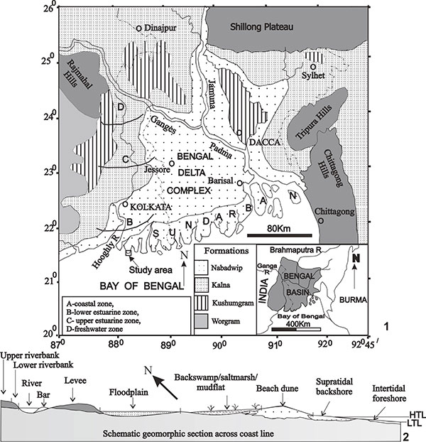
FIGURE 2. Geological and geomorphological map of the Bakkhali beach showing different ichnological subzones, location of long trackways, and stable and unstable beach segments.
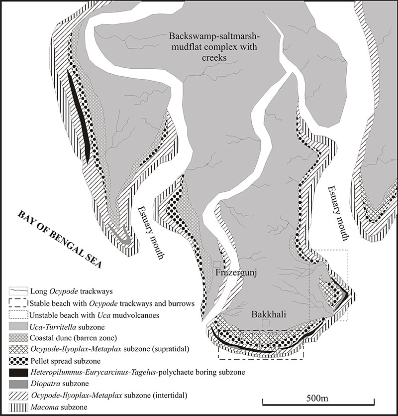
FIGURE 3. Distant view of the longest observed Ocypode trackway (shown by arrow). Note the positions of land and sea, trackway continuity, trackway maneuvering, and trackway morphology in different geomorphic units (1), Ocypode trackways on dry supratidal sand (2), best engraved trackway in moist sand of middle intertidal flat (3), trackway in very moist sands of lower intertidal flat (4). Note substrate specific morphological variations of the trackways. The scale measures 16 cm.
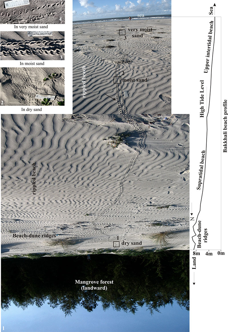
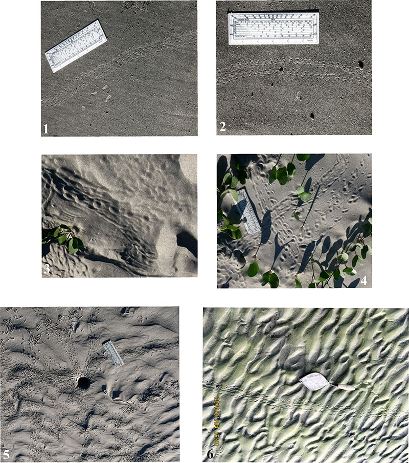
FIGURE 4. Close views and line drawings of best produced trackways for morphological details. Arrow heads indicate the direction of movement: moving upward trackway (1) and its line drawing (2), moving downward crab trackway (3) overprinted by bird trackway and its line drawing (4), trackway moving zigzag maneuvering mangrove bushes on the left (5) and fossilized decapods trackways from Eocene Mithakhari Group of Andaman Islands (6), the closest possible ancient analogue of the describe modern longest crab trackways from Bay of Bengal coast. The scale measures 16 cm.
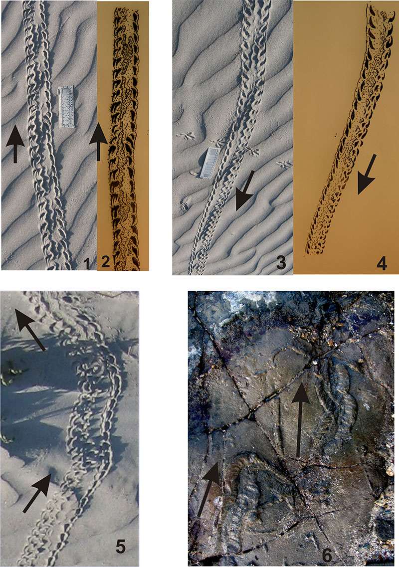
FIGURE 5. Photographs show variations in trackway morphology. Trackways produced on very moist substrate of lower intertidal flat - note morphological indistinctiveness (1-2); trackway made on dune slope - note morphological changes due to sliding effect (3); trackways produced on dry and flat sand surface - note their different appearance (4); shorter, narrower, freely wandering, and self-crossing young Ocypode trackways produced around a burrow opening in the moist middle intertidal flat as a result of searching food and feeding pellet making activity (5); long trackway produced on extra rigid and sticky biomat substrate in the supratidal depression - note different morphological appearance relative to the others (6). The scale measures 16 cm.