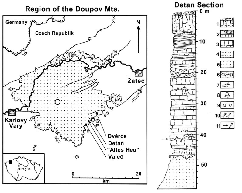
Figure 1. Area of the Doupov Mountains stratovolcano (dotted) between the towns Karlovy Vary and Zatec along the Ohre River rift of northwest Bohemia. The presumed center of the eruption is indicated by a circle. The northern part of the volcanic area is cut by the main tectonic line of the rift. The fossiliferous sites Dvérce, Detan, Altes Heu, and Valec are in the basal level of volcanic ashes on the southeast border of the volcano. Right: Geological section of the clay pit near the village Detan: fine sandy whitish clay (5), lenses of quartzites (6), brownish clay-rich sandy tuffs (4), sequence of heavy-fine bedded occasionally cross-bedded tuffs (2,3,7-11: remains of fossil angiosperm roots and woods (7, 8), record of leaves (9), fragments of bones and teeth (10), fossiliferous layer (11, see arrow in fig. 3.)), strongly weathered two-phased basalt lava flow on the top (1).