|
|
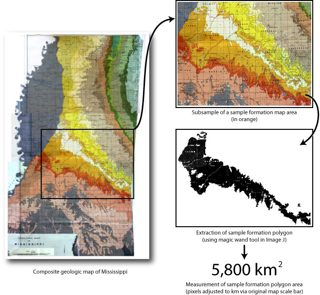
Figure 1. Graphic representation of the method used to measure map area of rocks from geologic maps. In this example, the undifferentiated Jackson Group (Eocene) of Mississippi is highlighted for measurement. The black and white bitmapped image of the Jackson Group is exported to ImageJ for measurement, based on the scale of the original map.
|