|
|
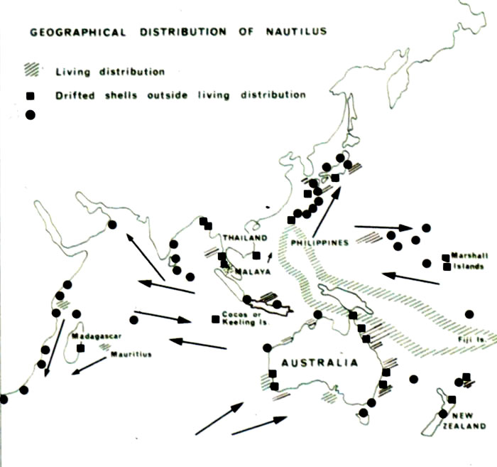
Figure. 1. Updating of the sketch map published in Reyment (1973) illustrating the geographical distribution of Nautilus s. l. in the Pacific and Indian Oceans. This figure includes information from the maps of House (1987, figures 1, 3) and more recently acquired data. The arrows denote major oceanic currents of presumed significance for the nekroplanktonic and living distributions of Nautilus. The black dots denote reports of nekroplanktonically dispersed shells since the original sketch-map of Reyment (1973) was published. The earlier reports are represented by black squares.
|