|
|
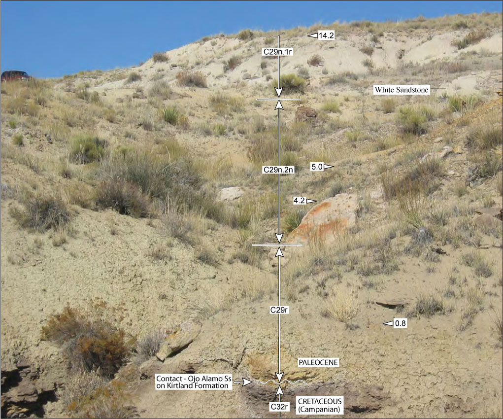
Figure 16. Photograph of Ojo Alamo Sandstone near head of tributary of Hunter Wash (looking north); location is shown on Figure 3 and Figure 4. Dinosaur-bone locality 022899-OA1 (Figure 4) is near base of white sandstone bed shown in upper right of photograph and is about 30 m to southeast. This dinosaur-bone collection site is 7.3 m above base of Ojo Alamo Sandstone. Sample levels of paleomagnetic data points are shown in meters above base of Ojo Alamo Sandstone; arrowheads pointing left indicate reversed polarity, arrowheads pointing right indicate normal polarity. Stratigraphic levels of samples are relatively accurate, as shown, but locations are not exact. Magnetochron labels are corrected as discussed in section of this paper labeled "Identification of Kirtland Formation-Ojo Alamo Sandstone Magnetochrons." Note vehicle in upper left on skyline for scale. See Figure 14 and Figure 15 for paleomagnetic data plots for this area.
|