|
|
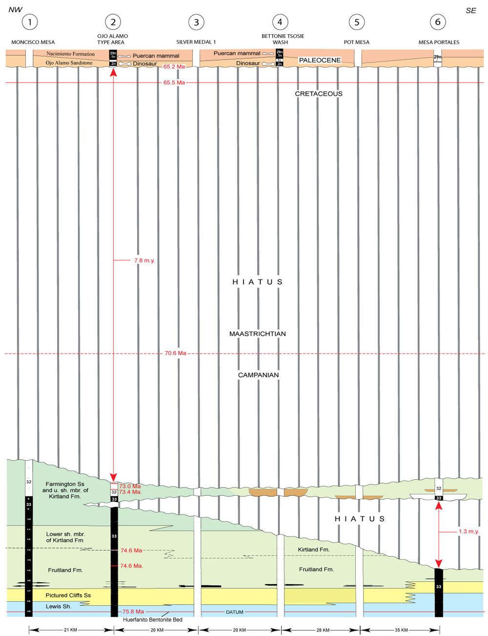
Figure 35. Time-stratigraphic cross section along southwest margin of San Juan Basin (line of section on Figure 3). Modified from Figure 34 to show magnitude of Fruitland-Kirtland and pre-Ojo Alamo Sandstone hiatuses at same scale. (See Figure 33 for drill-hole identifications.) Vertical exaggeration = 85 x.
|