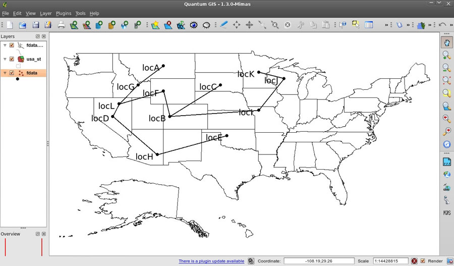
FIGURE 4. A screen shot from Quantum GIS, showing the exported latitude and MST shapefiles on a map of the USA.