FIGURE 1. Top: location maps. Insert: location of the Azores archipelago in the Northeast Atlantic and location of Santa Maria Island, within the Azores Archipelago. Bottom: map of Santa Maria with the location of the most important Mio-Pliocene and Pleistocene (MIS 5e) outcrops– 1, Ponta dos Frades; 2, Cré; 3, Lagoinhas; 4, Ponta do Norte; 5, Ponta Negra; 6, Ponta do Cedro; 7, Ponta do Castelo; 8, Pedra-que-pica; 9, Vinha Velha; 10, Pedrinha da Cré; 11, Baía de Nossa Senhora; 12, Malbusca; 13, West fault of Malbusca; 14, Ichnofossil’s cave; 15, Praia do Calhau; 16, Macela; 17, Prainha; 18, Figueiral; 19, Pedreira do Campo; 20, Airport.
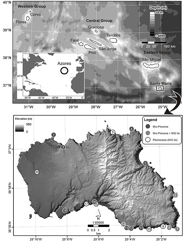
FIGURE 2. Right mandibular corpus (DBUA-F 1079) belonging to a medium-large size Mysticeti. 1, dorsal view; 2, lateral view; and 3, inset magnification of unknown bone modification to the lateral surface (denoted by arrows). Abbreviation “mc” indicates the mandibular canal. Thick broken arrows show passages of the mandibular canal through the fragment.
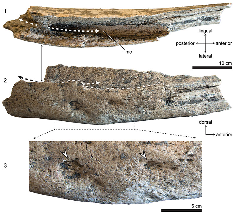
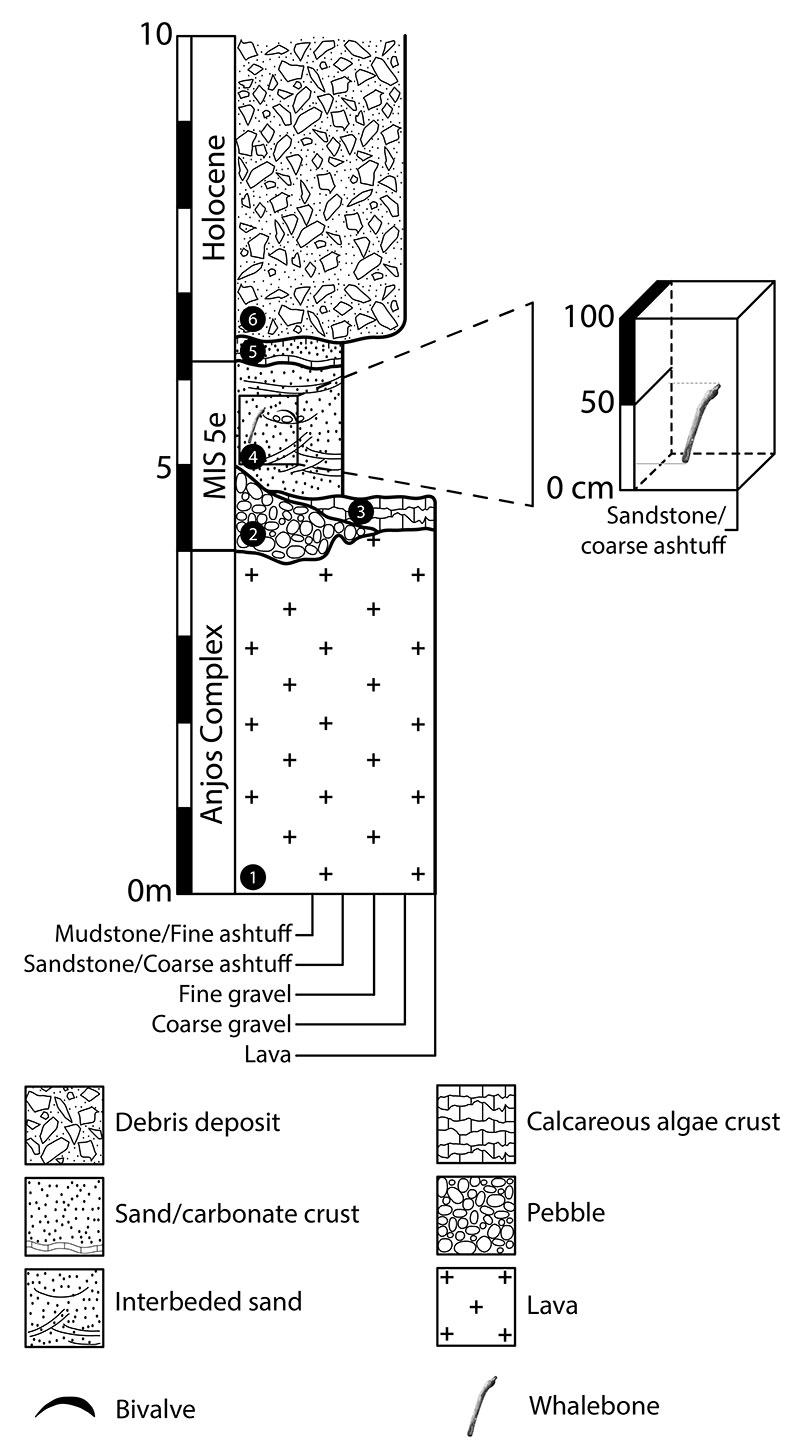
FIGURE 3. Detailed composite stratigraphic column at Praia do Calhau. The numbers depicted in filled circles correspond to facies 1-7, which are described in Ávila et al. (2015).