FIGURE 1. Map showing the distribution of the Clarno and John Day Formations in central and eastern Oregon, as well as the location of the three units of John Day Fossil Beds National Monument and other localities mentioned here. The Clarno Formation is represented by light shaded area, while the eastern, western, and southern facies of the John Day Formation are represented in darker shading. Map modified from Robinson et al. (1984) and Albright et al. (2008).
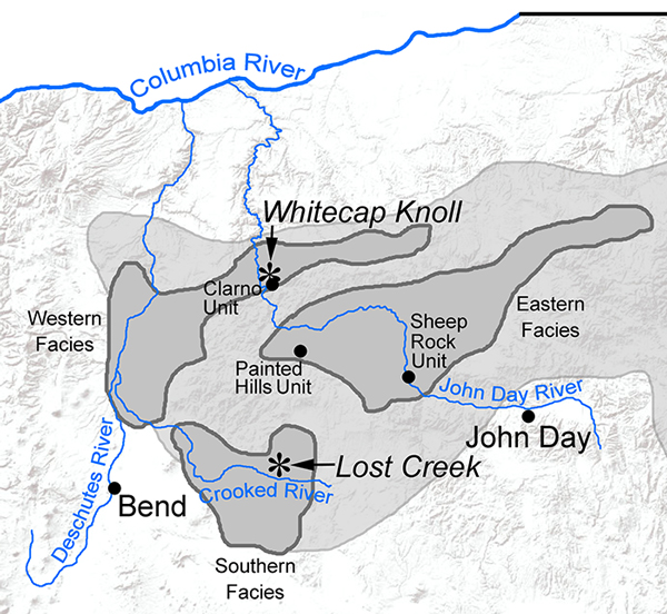
FIGURE 2. Composite stratigraphic column of the upper portion of the Clarno Formation and lower portion of the John Day Formation with stratigraphic ranges of Eocene rodents from Oregon. Composite stratigraphy based on Bestland and Retallack (1994), Bestland et al. (1999), Retallack et al. (2000), and Fremd (2010). Radiometric dates also derived from those sources, along with Manchester (2000) and Manchester and McIntosh (2007).
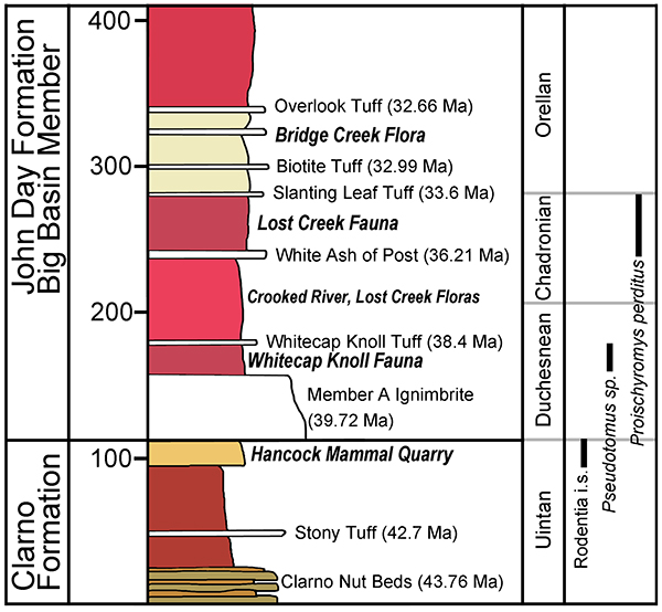
FIGURE 3. Rodentia incisor fragments from the Clarno Formation, Oregon. JODA 16822, 3.1. anterior view, 3.2. lateral view, 3.3. distal view. UOMNH F-28304, 3.4. anterior view, 3.5. lateral view, 3.6. distal view. Scale bar equals 1 mm.
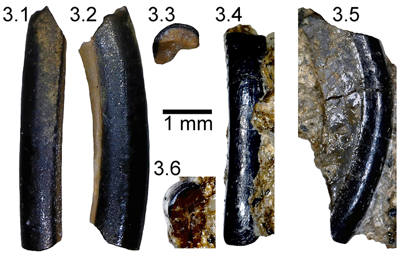
FIGURE 4. Pseudotomus sp. right m3, JODA 8900, from the Big Basin Member of the John Day Formation, Oregon. Scale bar equals 1 mm.
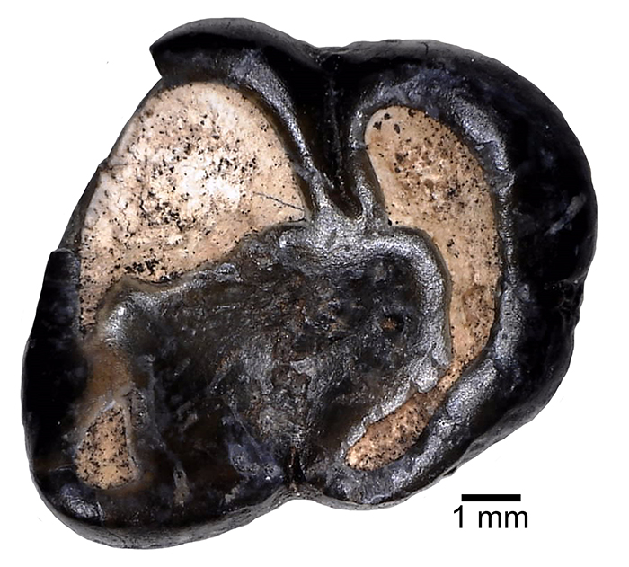
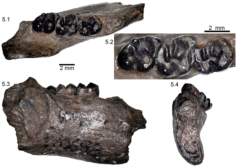
FIGURE 5. Proischyromys perditus n. gen., n. sp. right dentary with m1 - m3, UCMP 170698, from the Big Basin Member of the John Day Formation, Oregon. 5.1. occlusal view, 5.2. enlarged occlusal view, 5.3. lateral view, 5.4. anterior view. Scale bars equal 2 mm.