|
||||
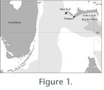
MATERIALS AND METHODSMost of the materials used in this study were collected during a series of dives using the Johnson Sea Link I and II submersibles (Harbor Branch Oceanographic Institute, Fort Pierce, Florida) between February 1991 and October 1998. The data include tens of hours of video taken using an externally-mounted video camera, hundreds of still photographs taken using externally-mounted as well as handheld reflex cameras, and time-lapse photographs taken with a Photosea (now Hydrovision) 1000A 35-mm underwater camera connected to a Photosea 1500S 150 watt-sec Strobe and mounted on a tripod deployed on the seafloor via submersible. Linear measurements were obtained from video images by using a pair of laser-generated dots visible on videotape and spaced 100 or 200 mm apart (depending upon the system used); the dots were produced by a pair of parallel lasers flanking the submersible's external video camera. Measurements were made post-dive by pausing the videotape; a millimeter rule was placed on the video screen over the scale bar and then over the image. All measurements were rounded to the nearest centimeter. A digital clock appearing on the videotape was used to measure time to the nearest second. Crawling speed was calculated as the ratio of the linear distance covered by the crawling crinoid to elapsed time. Because the orientation of the submersible and the camera changed during videotaping, and because magnification did not remain constant, crawling speeds were calculated incrementally.
Measured current velocities ranged from 0 to 400 mm sec-1, although flow sometimes clearly exceeded this. Temperatures recorded in situ range from 12o C (February 1991) to 17o C (October 1991). Detailed analyses of the flow environment in the northern Straits of Florida are in Düing (1975), Schott and Zantopp (1985) and Leaman et al. (1987). |
||||
|
|